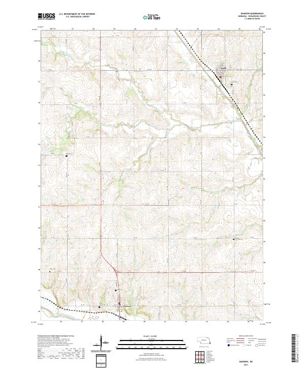
2021 Map of Dawson
USGS Topo · Published 2021About this map
The North Fork Big Nemaha River flows along the southern edge of this Richardson County landscape, where the settlements of Dawson and Stella serve as the primary hubs. This area is defined by an intricate network of creeks and runs, including Whisky Run, Wolf Cr, and Little Muddy Cr, which carve through the agricultural terrain. For those tracing local heritage, the map identifies several distinct burial sites such as Saint Marys Cem and Heim Cem near Dawson, as well as Stella Cem to the north.
Find a feature on this map
42 named features on this map. Tap any name to fly to it.
Don’t see what you’re looking for? This feature index may not catch every label — zoom into the map to look around manually.
Map Details
Editions of this 2021 Dawson Map
This is the sole edition of this map. No revisions or reprints were ever made.
Other maps of this area

1915 · Falls City
USGS Topo · 1:62,500

1915 · Nemaha
USGS Topo · 1:62,500

1915 · Howe
USGS Topo · 1:62,500

1916 · Humboldt
USGS Topo · 1:62,500

1939 · Nemaha
USGS Topo · 1:62,500

1949 · Nemaha
USGS Topo · 1:62,500

1955 · Nebraska City
USGS Topo · 1:250,000

1957 · Nebraska City
USGS Topo · 1:250,000

1958 · Nebraska City
USGS Topo · 1:250,000
1965 · Salem
USGS Topo · 1:24,000