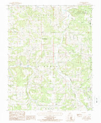
1987 Map of Dawson
USGS Topo · Published 1987About this map
Dawson and the surrounding hills of Wright County define this rural landscape during the late twentieth century. Located in the heart of the Ozarks, the area is characterized by a dense network of watercourses, including the North Fork Beaver Creek and Dove Creek, which carve through the terrain of Van Buren and Wood townships. Small settlements and crossroads like Graff, Rayborn, and Graves represent the localized community structure of the era, while the eastern portion of the sheet is dominated by the Mark Twain National Forest.
Find a feature on this map
28 named features on this map. Tap any name to fly to it.
Don’t see what you’re looking for? This feature index may not catch every label — zoom into the map to look around manually.
Map Details
Editions of this 1987 Dawson Map
This is the sole edition of this map. No revisions or reprints were ever made.
Other maps of this area

1931 · Manes
USGS Topo · 1:48,000

1941 · Manes
USGS Topo · 1:62,500

1941 · Bado
USGS Topo · 1:62,500

1943 · Manes
USGS Topo · 1:62,500

1943 · Bado
USGS Topo · 1:62,500

1951 · Mountain Grove North
USGS Topo · 1:24,000

1951 · Cabool NW
USGS Topo · 1:24,000

1951 · Owens
USGS Topo · 1:24,000

1951 · Cabool
USGS Topo · 1:62,500

1951 · Mountain Grove
USGS Topo · 1:62,500