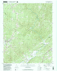
1997 Map of Dawsonville
USGS Topo · Published 1999About this map
The Etowah River carves a winding path through this North Georgia landscape, defining the character of the terrain between Dawsonville and the community of Auraria. The map provides a detailed view of the regional drainage network, including Cane Creek, Shoal Creek, and Russell Creek, which all feed into the larger river systems. Settlement patterns here are characterized by small crossroads and community centers like Landrum and Burtsboro, often centered around spiritual and civic life as seen at New Bethel Ch and its associated New Bethel Cem. Near the southern edge, the Hightower State Nursery occupies a significant tract along the riverbank, while landmarks like the Pumping Station and Gaging Station indicate the ongoing management of local water resources. This survey illustrates a period when rural identity remained tied to long-standing family names and community landmarks even as the area around the county seat began to modernize.
Find a feature on this map
43 named features on this map. Tap any name to fly to it.
Don’t see what you’re looking for? This feature index may not catch every label — zoom into the map to look around manually.
Map Details
Editions of this 1997 Dawsonville Map
This is the sole edition of this map. No revisions or reprints were ever made.
Other maps of this area

1886 · Dahlonega
USGS Topo · 1:125,000

1888 · Ellijay
USGS Topo · 1:125,000

1890 · Suwanee
USGS Topo · 1:125,000

1891 · Gainesville
USGS Topo · 1:125,000

1892 · Dahlonega
USGS Topo · 1:125,000

1892 · Ellijay
USGS Topo · 1:125,000

1894 · Suwanee
USGS Topo · 1:125,000

1896 · Dahlonega
USGS Topo · 1:125,000

1898 · Ellijay
USGS Topo · 1:125,000

1903 · Dahlonega
USGS Topo · 1:125,000