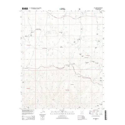
2014 Map of Day Spring
USGS Topo · Published 2014About this map
The Mogollon Plateau landscape within the Sitgreaves National Forest is defined by a complex network of high-altitude drainages and ridges. In this high country, water management is central to the land's utility, evidenced by a high density of tanks such as Newman Tank, Lower Yarrow Tank, and Williams Tanks. The rugged terrain is carved by deep canyons and washes, including Decker Wash and Rhine Canyon, which descend from the dominant ridges. A primary artery for the region is the Mogollon Rim Rd, which traces the dramatic edge of the escarpment. Local history is reflected in several named springs that likely served as critical water sources for early forest users, such as Day Spring, Trough Spring, and Shingle Spring. The northern portion of the map is intersected by State Hwy 260, contrasting the modern transit route with the more primitive tracks like Williams Rd that penetrate the dense forest interior.
Find a feature on this map
63 named features on this map. Tap any name to fly to it.
Don’t see what you’re looking for? This feature index may not catch every label — zoom into the map to look around manually.
Map Details
Editions of this 2014 Day Spring Map
This is the sole edition of this map. No revisions or reprints were ever made.
Other maps of this area

1886 · Holbrook
USGS Topo · 1:250,000

1893 · Holbrook
USGS Topo · 1:250,000

1954 · Holbrook
USGS Topo · 1:250,000

1957 · Holbrook
USGS Topo · 1:250,000

1958 · Holbrook
USGS Topo · 1:250,000

1960 · Holbrook
USGS Topo · 1:250,000

1961 · Clay Springs
USGS Topo · 1:62,500

1961 · Heber
USGS Topo · 1:62,500

1961 · Cibecue
USGS Topo · 1:62,500

1961 · Chediski Peak
USGS Topo · 1:62,500