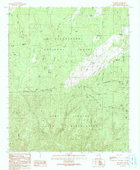
1990 Map of Day Spring
USGS Topo · Published 1991About this map
The Mogollon Rim escarpment dominates this landscape, serving as a dramatic physical and administrative boundary within the Sitgreaves National Forest. South of this geological divide, the terrain drops into the Fort Apache Indian Reservation, where a complex network of drainages like Rhine Canyon and Coal Canyon carve through Rhine Ridge and Bear Ridge. The high country is characterized by numerous water management features essential for land use, including Dead Horse Tank, Newman Tank, and Lincoln Tank.
Find a feature on this map
57 named features on this map. Tap any name to fly to it.
Don’t see what you’re looking for? This feature index may not catch every label — zoom into the map to look around manually.
Map Details
Editions of this 1990 Day Spring Map
This is the sole edition of this map. No revisions or reprints were ever made.
Other maps of this area

1886 · Holbrook
USGS Topo · 1:250,000

1893 · Holbrook
USGS Topo · 1:250,000

1954 · Holbrook
USGS Topo · 1:250,000

1957 · Holbrook
USGS Topo · 1:250,000

1958 · Holbrook
USGS Topo · 1:250,000

1960 · Holbrook
USGS Topo · 1:250,000

1961 · Clay Springs
USGS Topo · 1:62,500

1961 · Heber
USGS Topo · 1:62,500

1961 · Cibecue
USGS Topo · 1:62,500

1961 · Chediski Peak
USGS Topo · 1:62,500