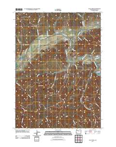
2011 Map of Days Creek
USGS Topo · Published 2011About this map
The South Umpqua River snakes through this Douglas County landscape, serving as the primary corridor for settlement and transit near the communities of Days Creek and Gazley. The topography is defined by the steep ascents of Beals Mountain and Hyde Ridge, where numerous seasonal and perennial drainages like Shively Creek and Beals Creek carve out deep gulches. Local infrastructure is anchored by the Days Creek Post Office and the Caroline Raymond Bridge, which facilitates movement across the river. For those researching family history, the Bland Mountain Cemetery sits on a high point overlooking the Bland Branch, while the Riverview Ranch Airport indicates modern land use along the valley floor. The map also documents a complex network of forest access routes, including several Bureau of Land Management roads such as BLM 31-4-11.1 RD, which penetrate the higher elevations north and south of the river valley.
Find a feature on this map
51 named features on this map. Tap any name to fly to it.
Don’t see what you’re looking for? This feature index may not catch every label — zoom into the map to look around manually.
Map Details
Editions of this 2011 Days Creek Map
This is the sole edition of this map. No revisions or reprints were ever made.
Other maps of this area

1897 · Roseburg
USGS Topo · 1:125,000

1900 · Roseburg
USGS Topo · 1:125,000

1904 · Riddle
USGS Topo · 1:125,000

1954 · Dixonville
USGS Topo · 1:62,500

1954 · Days Creek
USGS Topo · 1:62,500

1954 · Canyonville
USGS Topo · 1:62,500

1955 · Roseburg
USGS Topo · 1:62,500

1955 · Medford
USGS Topo · 1:250,000

1957 · Medford
USGS Topo · 1:250,000

1958 · Medford
USGS Topo · 1:250,000