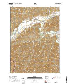
2020 Map of Days Creek
USGS Topo · Published 2020About this map
The South Umpqua River snakes through the center of this Douglas County landscape, serving as the primary corridor for settlement and transit. The small community of Days Creek is situated along its northern banks, flanked by the residential area of The Heights and the Caroline Raymond Bridge. To the west, the settlement of Gazley marks another point of human activity near the river's bend. The terrain is defined by a series of steep drainages including Clough Gulch, Packard Gulch, and Stinger Gulch, which feed into the main waterway.
Find a feature on this map
71 named features on this map. Tap any name to fly to it.
Don’t see what you’re looking for? This feature index may not catch every label — zoom into the map to look around manually.
Map Details
Editions of this 2020 Days Creek Map
This is the sole edition of this map. No revisions or reprints were ever made.
Other maps of this area

1897 · Roseburg
USGS Topo · 1:125,000

1900 · Roseburg
USGS Topo · 1:125,000

1904 · Riddle
USGS Topo · 1:125,000

1954 · Dixonville
USGS Topo · 1:62,500

1954 · Days Creek
USGS Topo · 1:62,500

1954 · Canyonville
USGS Topo · 1:62,500

1955 · Roseburg
USGS Topo · 1:62,500

1955 · Medford
USGS Topo · 1:250,000

1957 · Medford
USGS Topo · 1:250,000

1958 · Medford
USGS Topo · 1:250,000