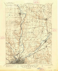
1906 Map of Dayton
USGS Topo · Published 1948About this map
Dayton sits at the southern convergence of a massive river system where the Stillwater River and Mad River join the Miami River. This 1906 survey captures the Montgomery County region when it was a dense network of traction lines and steam railroads, featuring the Dayton and Troy Turnpike and the historic National Road cutting across the landscape. The map preserves several locations that would later undergo significant change, including the town of Osborn, which was famously relocated after the 1913 flood, and Fairfield, which later merged with its neighbor. Significant civil engineering is noted at Taylorsville Dam and Huffman Dam. Smaller settlements and stops such as Tippecanoe City, Ginghamsburg, and Phoneton are documented alongside specialized points like Browns Res PO, providing a detailed look at the rural and municipal organization of early 20th-century Ohio.
Find a feature on this map
65 named features on this map. Tap any name to fly to it.
Don’t see what you’re looking for? This feature index may not catch every label — zoom into the map to look around manually.
Map Details
Editions of this 1906 Dayton Map
2 editions found
Other maps of this area

1904 · Springfield
USGS Topo · 1:62,500

1904 · Dayton
USGS Topo · 1:62,500

1905 · Brookville
USGS Topo · 1:62,500

1906 · Dayton
USGS Topo · 1:62,500

1906 · Springfield
USGS Topo · 1:62,500

1908 · Miamisburg
USGS Topo · 1:62,500

1911 · Covington
USGS Topo · 1:62,500

1913 · Waynesville
USGS Topo · 1:62,500

1914 · Troy
USGS Topo · 1:62,500

1914 · St. Paris
USGS Topo · 1:62,500