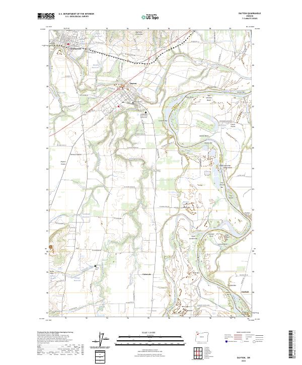
2024 Map of Dayton
USGS Topo · Published 2024About this map
Dayton and Lafayette anchor this survey of the northern Willamette Valley, where the Yamhill River winds through a landscape defined by fertile river bars and agricultural prairies. The terrain transitions from the elevations of the Red Hills of Dundee and the Amity Hills to the broad expanse of French Prairie. The river's winding path is marked by numerous features such as San Salvador Beach, Candiani Bar, and Weston Bend, illustrating the historical importance of the waterway to the region's transport and irrigation. Genealogists will find significant local landmarks including Brookside Cem, the Irindependent Order of Odd Fellows Cem, and the O'Dell Cem. The distribution of water resources is evident through several private impoundments like Stockhoff Reservoir, Michael Reservoir, and Kunz Reservoir, reflecting the intensive land use in this productive corner of Yamhill County.
Find a feature on this map
117 named features on this map. Tap any name to fly to it.
Don’t see what you’re looking for? This feature index may not catch every label — zoom into the map to look around manually.
Map Details
Editions of this 2024 Dayton Map
This is the sole edition of this map. No revisions or reprints were ever made.
Other maps of this area

1916 · Tualatin
USGS Topo · 1:62,500

1923 · Mount Angel
USGS Topo · 1:62,500

1924 · Mc Minnville
USGS Topo · 1:48,000

1926 · Mc Minnville
USGS Topo · 1:62,500

1939 · Tualatin
USGS Topo · 1:62,500

1940 · McMinnville
USGS Topo · 1:62,500

1940 · Tualatin
USGS Topo · 1:62,500

1940 · Mount Angel
USGS Topo · 1:62,500

1941 · Yamhill
USGS Topo · 1:62,500

1942 · Yamhill
USGS Topo · 1:62,500