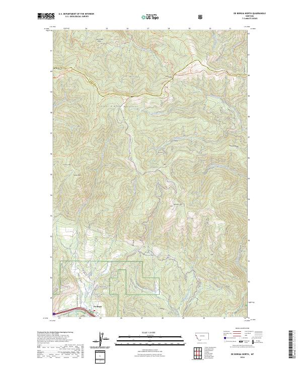
2024 Map of De Borgia North
USGS Topo · Published 2024About this map
De Borgia sits at the southern edge of this map where the Saint Regis River valley meets the steep elevations of the Coeur d'Alene Mountains. The landscape is defined by the high ridges and drainage basins of the Lolo National Forest, where historical access is marked by an extensive network of trails and forest roads. Significant summits like Mt Bushnell, Brooks Mtn, and Goat Mtn dictate the rugged geography, while numerous passes such as Joan Creek Pass and Knox Pass indicate the natural corridors used to traverse the divide between Sanders Co and Mineral Co. The presence of labels like Hiawatha and the Cc Divide Trl highlights a legacy of transit and resource management in the western Montana backcountry. Settled areas are confined to the river corridor, leaving the north dominated by named creeks like Twelvemile Creek and Rock Creek.
Find a feature on this map
57 named features on this map. Tap any name to fly to it.
Don’t see what you’re looking for? This feature index may not catch every label — zoom into the map to look around manually.
Map Details
Editions of this 2024 De Borgia North Map
This is the sole edition of this map. No revisions or reprints were ever made.
Other maps of this area

1918 · St Regis
USGS Topo · 1:125,000

1919 · St. Regis
USGS Topo · 1:125,000

1937 · Thompson Falls
USGS Topo · 1:125,000

1937 · Thompson Falls
USGS Topo · 1:62,500

1956 · St Regis
USGS Topo · 1:62,500

1956 · Wallace
USGS Topo · 1:250,000

1957 · Thompson Falls
USGS Topo · 1:62,500

1957 · Haugan
USGS Topo · 1:62,500

1960 · Wallace
USGS Topo · 1:250,000

1964 · Eddy Mountain
USGS Topo · 1:24,000