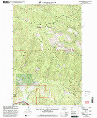
1999 Map of De Borgia North
USGS Topo · Published 2003About this map
The Coeur d'Alene Mountains dominate this late-twentieth-century landscape, where the CC Divide forms a high-elevation boundary between Sanders and Mineral Counties. The area is defined by the steep drainage basins of the St Regis River, where the small settlement of De Borgia sits at the southern edge of the quadrangle. This map captures a legacy of hard-rock mining tucked into the forested ridges of the Lolo National Forest, with several named operations including the Copper Rock Mine, Texas Mine, and Valentine Mine scattered across the rugged terrain.
Find a feature on this map
33 named features on this map. Tap any name to fly to it.
Don’t see what you’re looking for? This feature index may not catch every label — zoom into the map to look around manually.
Map Details
Editions of this 1999 De Borgia North Map
This is the sole edition of this map. No revisions or reprints were ever made.
Other maps of this area

1918 · St Regis
USGS Topo · 1:125,000

1919 · St. Regis
USGS Topo · 1:125,000

1937 · Thompson Falls
USGS Topo · 1:125,000

1937 · Thompson Falls
USGS Topo · 1:62,500

1956 · St Regis
USGS Topo · 1:62,500

1956 · Wallace
USGS Topo · 1:250,000

1957 · Thompson Falls
USGS Topo · 1:62,500

1957 · Haugan
USGS Topo · 1:62,500

1960 · Wallace
USGS Topo · 1:250,000

1964 · Eddy Mountain
USGS Topo · 1:24,000