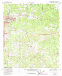
1973 Map of De Funiak Springs East
USGS Topo · Published 1988About this map
Lake De Funiak serves as the focal point of De Funiak Springs, where the city's street grid, including Baldwin Ave and Sloss Ave, radiates from the perfectly circular water body. This 1973 survey shows the town as a well-established county seat, complete with its Courthouse, Magnolia Cem, and a local hospital. The Louisville and Nashville railroad runs parallel to the main thoroughfare, marking the industrial corridor that shaped the town's development.
Find a feature on this map
57 named features on this map. Tap any name to fly to it.
Don’t see what you’re looking for? This feature index may not catch every label — zoom into the map to look around manually.
Map Details
Editions of this 1973 De Funiak Springs East Map
2 editions found
Other maps of this area

1935 · De Funiak Springs
USGS Topo · 1:48,000

1938 · De Funiak Springs
USGS Topo · 1:62,500

1948 · Ponce De Leon
USGS Topo · 1:24,000

1949 · Glendale
USGS Topo · 1:62,500

1949 · Redbay
USGS Topo · 1:24,000

1950 · Prosperity
USGS Topo · 1:24,000

1950 · Ponce De Leon
USGS Topo · 1:24,000

1950 · Redbay
USGS Topo · 1:24,000

1951 · Glendale
USGS Topo · 1:62,500

1954 · Tallahassee
USGS Topo · 1:250,000