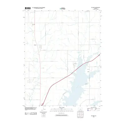
2010 Map of De Graff
USGS Topo · Published 2010About this map
El Dorado Lake dominates the southern landscape of this Butler County region, its northern reaches flooding the valley where the Walnut River and West Branch Walnut River converge. The settlement of Chelsea sits near the eastern shore, a community with deep roots evidenced by the nearby Chelsea Cemetery. To the northwest, De Graff serves as a northern anchor point for the rural road network, which follows a rigid grid of section lines like NW Pickerell RD and Ne 85th ST. This topography reflects the modern management of Kansas water resources, where the reservoir has reshaped the original river drainage. Genealogists can find significant local landmarks such as the Ridgeway Cemetery, while the presence of named tributaries like Gilmore Branch provides specific points of reference for tracing historic land tracts in the Flint Hills transition.
Find a feature on this map
31 named features on this map. Tap any name to fly to it.
Don’t see what you’re looking for? This feature index may not catch every label — zoom into the map to look around manually.
Map Details
Editions of this 2010 De Graff Map
This is the sole edition of this map. No revisions or reprints were ever made.
Other maps of this area

1888 · Eldorado
USGS Topo · 1:125,000

1898 · Cottonwood Falls
USGS Topo · 1:125,000

1955 · Wichita
USGS Topo · 1:250,000

1955 · Hutchinson
USGS Topo · 1:250,000

1958 · Wichita
USGS Topo · 1:250,000

1959 · Hutchinson
USGS Topo · 1:250,000

1961 · Pontiac
USGS Topo · 1:24,000

1961 · De Graff
USGS Topo · 1:24,000

1961 · El Dorado NW
USGS Topo · 1:24,000

1961 · El Dorado
USGS Topo · 1:24,000