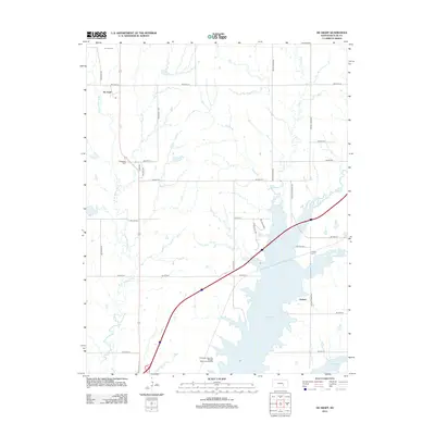
2012 Map of De Graff
USGS Topo · Published 2012About this map
El Dorado Lake dominates the southern landscape of this Butler County region, its northern reaches fed by the Walnut River and the W Br Walnut River. The settlement of De Graff sits in the northwest near the confluence of several small branches, while Chelsea is positioned near the eastern shore of the reservoir. This modern topographic study shows the rural road network in transition as it meets the recreational infrastructure of the El Dorado State Park Boulder Bluff Camping Area. Local history is anchored by the presence of Ridgeway Cem and Chelsea Cem, which remain as permanent markers of the community's early development. The drainage patterns of Gilmore Br, Cole Cr, and Durechen Cr illustrate the natural hydrology that precedes the creation of the large artificial lake.
Find a feature on this map
38 named features on this map. Tap any name to fly to it.
Don’t see what you’re looking for? This feature index may not catch every label — zoom into the map to look around manually.
Map Details
Editions of this 2012 De Graff Map
This is the sole edition of this map. No revisions or reprints were ever made.
Other maps of this area

1888 · Eldorado
USGS Topo · 1:125,000

1898 · Cottonwood Falls
USGS Topo · 1:125,000

1955 · Wichita
USGS Topo · 1:250,000

1955 · Hutchinson
USGS Topo · 1:250,000

1958 · Wichita
USGS Topo · 1:250,000

1959 · Hutchinson
USGS Topo · 1:250,000

1961 · Pontiac
USGS Topo · 1:24,000

1961 · De Graff
USGS Topo · 1:24,000

1961 · El Dorado NW
USGS Topo · 1:24,000

1961 · El Dorado
USGS Topo · 1:24,000