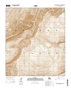
2014 Map of De Long Mountains D-3 NW
USGS Topo · Published 2014About this map
Kahkatak Cr and Turbid Cr carve through the high-elevation terrain of the De Long Mountains in this northern Alaskan survey. The landscape is defined by the headwaters of several drainages, including Ainatusuk Cr in the northeast and Akulik Cr in the southwest corner. The map documents the intricate topography of the North Slope Borough, where the terrain shifts between steep ridges and narrow stream valleys. This specific quadrangle covers portions of four townships including t5s r50w and t6s r49w, providing a precise record of the natural hydrology and land divisions in a wilderness area devoid of permanent settlements or modern road infrastructure.
Find a feature on this map
8 named features on this map. Tap any name to fly to it.
Don’t see what you’re looking for? This feature index may not catch every label — zoom into the map to look around manually.
Map Details
Editions of this 2014 De Long Mountains D-3 NW Map
This is the sole edition of this map. No revisions or reprints were ever made.
Other maps of this area

1951 · De Long Mountains
USGS Topo · 1:250,000

1951 · Point Lay
USGS Topo · 1:250,000

1955 · De Long Mountains
USGS Topo · 1:250,000

1955 · Point Lay
USGS Topo · 1:250,000
1955 · Point Lay A-3 & 4
USGS Topo · 1:63,360
1955 · De Long Mountains D-3
USGS Topo · 1:63,360

1955 · De Long Mountains D-4
USGS Topo · 1:63,360

1965 · Point Lay
USGS Topo · 1:250,000

1965 · De Long Mountains
USGS Topo · 1:250,000
2014 · Point Lay A-3 SW
USGS Topo · 1:25,000