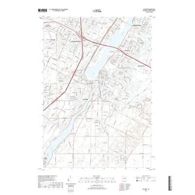
2018 Map of De Pere
USGS Topo · Published 2018About this map
The Fox River serves as the central artery for this portion of Brown County, defining the boundaries and development of De Pere and West De Pere. This late-2010s industrial and suburban landscape is characterized by the convergence of several major watercourses, including Ashwaubenon Creek, Dutchman Creek, and the East River. The map meticulously details the infrastructure surrounding the Green Bay-Austin Straubel International Airport in Ashwaubenon, alongside the dense residential grids of Allouez and Bellevue. Genealogists will find significant value in the numerous established burial grounds documented here, such as Allouez Catholic Cem, Woodlawn Cem, and Greenwood Cem. Farther south, the transition toward more open terrain is marked by the small settlement of Little Rapids and the winding course of Bower Cr, illustrating the reach of the Green Bay metropolitan area into its rural surroundings.
Find a feature on this map
51 named features on this map. Tap any name to fly to it.
Don’t see what you’re looking for? This feature index may not catch every label — zoom into the map to look around manually.
Map Details
Editions of this 2018 De Pere Map
This is the sole edition of this map. No revisions or reprints were ever made.
Other maps of this area

1954 · De Pere
USGS Topo · 1:62,500

1954 · Green Bay West
USGS Topo · 1:24,000

1954 · Denmark
USGS Topo · 1:62,500

1954 · De Pere
USGS Topo · 1:24,000

1954 · New Franken
USGS Topo · 1:62,500

1954 · Green Bay East
USGS Topo · 1:24,000

1954 · Manitowoc
USGS Topo · 1:250,000

1954 · Bellevue
USGS Topo · 1:24,000

1954 · Green Bay
USGS Topo · 1:62,500

1955 · Green Bay
USGS Topo · 1:250,000