
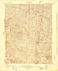
1931 Map of De Soto SE
USGS Topo · Published 1931About this map
Missouri Pacific railroad tracks wind through the difficult topography of the eastern Ozarks, following the valley of the Big River as it creates the boundary between Jefferson and St. Francois counties. This 1930s landscape is defined by its small, scattered rural communities and specialized points along the rail line, including the settlement at Vineland and the Tunnel Sta landmark. The survey provides a clear look at the early 20th-century educational and social network of the area, noting several distinct neighborhood schoolhouses such as Mothershead Sch, McGehan Sch, and Moontown Sch. The rugged hills are drained by numerous waterways, including Joachim Creek and Dripping Spring Creek, which cut through deep hollows. This era represents a time when State Highway No 21 was a primary artery connecting these high-elevation settlements like Melzo to the larger region.
Find a feature on this map
27 named features on this map. Tap any name to fly to it.
Don’t see what you’re looking for? This feature index may not catch every label — zoom into the map to look around manually.
Map Details
Editions of this 1931 De Soto SE Map
2 editions found
Other maps of this area

1901 · De Soto
USGS Topo · 1:125,000

1904 · Farmington
USGS Topo · 1:62,500

1905 · Bonneterre
USGS Topo · 1:62,500

1906 · Farmington
USGS Topo · 1:62,500

1915 · Crystal City
USGS Topo · 1:62,500

1930 · De Soto NE
USGS Topo · 1:24,000

1937 · Fletcher
USGS Topo · 1:24,000

1937 · Tiff
USGS Topo · 1:24,000

1938 · Fletcher
USGS Topo · 1:24,000

1939 · Tiff
USGS Topo · 1:24,000