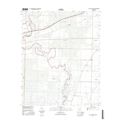
2017 Map of De Valls Bluff SE
USGS Topo · Published 2017About this map
Cache River and Bayou De View dominate this corner of eastern Arkansas, where the landscape is defined by a dense network of slow-moving waterways and bottomland sloughs. Small settlements like Eden and Dagmar are situated on the higher ground north of the wetlands, while Allendale sits to the east near the junction of Cane Ridge Rd and Moorehead Rd. The map reveals the intricate drainage patterns of the White River basin, including named bends and oxbows such as Ninety Point and Lost Lake. For those researching local family history, the presence of the Philadelphia Cem and Choctaw Cem provides specific points of interest in this predominantly agricultural and deltaic terrain. Numerous bayous, including Big Robe Bayou and Crosspond Bayou, illustrate the complex hydrology that has historically dictated the roads and settlement patterns of Monroe and Prairie Counties.
Find a feature on this map
40 named features on this map. Tap any name to fly to it.
Don’t see what you’re looking for? This feature index may not catch every label — zoom into the map to look around manually.
Map Details
Editions of this 2017 De Valls Bluff SE Map
This is the sole edition of this map. No revisions or reprints were ever made.
Other maps of this area

1935 · Clarendon
USGS Topo · 1:62,500

1940 · Holly Grove
USGS Topo · 1:62,500

1940 · Brinkley
USGS Topo · 1:62,500

1941 · De Valls Bluff
USGS Topo · 1:62,500

1941 · Clarendon
USGS Topo · 1:62,500

1948 · Helena
USGS Topo · 1:250,000

1950 · Helena
USGS Topo · 1:250,000

1955 · Helena
USGS Topo · 1:250,000
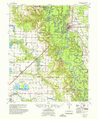
1957 · Clarendon
USGS Topo · 1:62,500

1957 · Holly Grove
USGS Topo · 1:62,500