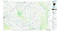
1986 Map of De Witt
USGS Topo · Published 1986About this map
The confluence of the Arkansas and White Rivers dominates this mid-1980s landscape, where industrial agriculture and conservation areas coexist. Large-scale institutions are prominent features of the region, including the extensive Tucker State Prison Farm and Cummins State Prison. The map details the complex hydraulics of the Delta, illustrated by the series of Lock and Dam No 4, Lock and Dam No 3, and Lock and Dam No 2 that manage the river's flow.
Find a feature on this map
156 named features on this map. Tap any name to fly to it.
Don’t see what you’re looking for? This feature index may not catch every label — zoom into the map to look around manually.
Map Details
Editions of this 1986 De Witt Map
2 editions found
Other maps of this area

1891 · Little Rock
USGS Topo · 1:125,000

1893 · Little Rock
USGS Topo · 1:125,000

1930 · Mellwood
USGS Topo · 1:62,500

1932 · Pastoria
USGS Topo · 1:62,500

1935 · Feenyville
USGS Topo · 1:62,500

1935 · Altheimer
USGS Topo · 1:62,500

1935 · Pastoria
USGS Topo · 1:62,500

1935 · Varner
USGS Topo · 1:62,500

1935 · Noble Lake
USGS Topo · 1:62,500

1935 · Rotan
USGS Topo · 1:62,500