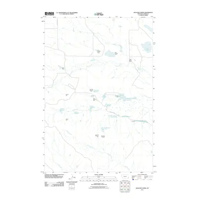
2011 Map of Dead Boy Divide
USGS Topo · Published 2011About this map
Dead Boy Divide serves as a central geographic feature in this corner of Carter County, where an extensive network of small dams and reservoirs manages water across the arid Montana landscape. The map reveals a systematic approach to water storage, with numerous impoundments named for various Native American tribes, including the Cheyenne Reservoir, Ute Reservoir, Blackfoot Reservoir, and Cherokee Reservoir. This concentrated water infrastructure implies a heavy reliance on managed resources for ranching or local agriculture in an otherwise dry terrain. Drainage patterns are defined by several key waterways such as Dead Boy Creek, Buffalo Creek, and Lone Tree Creek. Transportation in this sparsely populated area is limited to primitive routes like Chalk Buttes Rd and Lone Tree Rd, which provide access to remote landmarks like the Soda Lakes in the northeast.
Find a feature on this map
33 named features on this map. Tap any name to fly to it.
Don’t see what you’re looking for? This feature index may not catch every label — zoom into the map to look around manually.
Map Details
Editions of this 2011 Dead Boy Divide Map
This is the sole edition of this map. No revisions or reprints were ever made.
Other maps of this area

1954 · Ekalaka
USGS Topo · 1:250,000

1956 · Ekalaka
USGS Topo · 1:250,000

1958 · Ekalaka
USGS Topo · 1:250,000

1965 · Ekalaka
USGS Topo · 1:250,000

1979 · Dutchman Creek
USGS Topo · 1:24,000

1979 · Beaver Flats South
USGS Topo · 1:24,000

1979 · Dead Boy Divide
USGS Topo · 1:24,000

1979 · Ikey Creek
USGS Topo · 1:24,000

1979 · Chalk Buttes
USGS Topo · 1:24,000

1980 · Taylor Hills
USGS Topo · 1:24,000