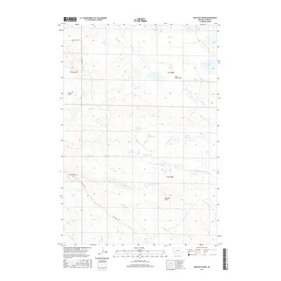
2017 Map of Dead Boy Divide
USGS Topo · Published 2017About this map
Dead Boy Divide dominates the central topography of this corner of Carter County, separating the drainages of the Dead Boy Cr and its northern fork from the tributaries that flow toward the Little Missouri. The landscape is defined by a complex network of reservoirs and ephemeral draws, reflecting the critical importance of water management in this arid stretch of eastern Montana. Names like Cheyenne Reservoir, Sioux Reservoir, and Navaho Reservoir suggest a commemorative mapping of the region's indigenous history alongside cattle-country features like the Soda Lakes. Human presence is sparse, marked primarily by the intersection of Lone Tree Rd and Chalk Buttes Rd, which follow the higher ground between the winding banks of Buffalo Cr and Chito Cr.
Find a feature on this map
26 named features on this map. Tap any name to fly to it.
Don’t see what you’re looking for? This feature index may not catch every label — zoom into the map to look around manually.
Map Details
Editions of this 2017 Dead Boy Divide Map
This is the sole edition of this map. No revisions or reprints were ever made.
Other maps of this area

1954 · Ekalaka
USGS Topo · 1:250,000

1956 · Ekalaka
USGS Topo · 1:250,000

1958 · Ekalaka
USGS Topo · 1:250,000

1965 · Ekalaka
USGS Topo · 1:250,000

1979 · Dutchman Creek
USGS Topo · 1:24,000

1979 · Beaver Flats South
USGS Topo · 1:24,000

1979 · Dead Boy Divide
USGS Topo · 1:24,000

1979 · Ikey Creek
USGS Topo · 1:24,000

1979 · Chalk Buttes
USGS Topo · 1:24,000

1980 · Taylor Hills
USGS Topo · 1:24,000