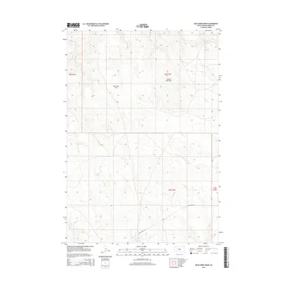
2015 Map of Dead Horse Draw
USGS Topo · Published 2015About this map
Dead Horse Draw and Chasing Hawk Draw define the topography of this high plains landscape in Ziebach County. The drainage network is dense with intermittent waterways including Cherry Cr, Deer Cr, Johnny Cr, and Bull Cr, which carve through the terrain as they move toward the larger basin. While the area remains largely open rangeland, the presence of Cherry Creek Rd and Bia-13 indicates the essential transit routes connecting this part of the Cheyenne River Indian Reservation. The map shows the section lines of Townships 8 and 9 North, providing a precise grid for those tracing land allotments or historical property boundaries. This 2015 survey reflects a landscape where the natural hydrology of draws and creeks like Felix Cr continues to dictate the patterns of movement and use.
Find a feature on this map
13 named features on this map. Tap any name to fly to it.
Don’t see what you’re looking for? This feature index may not catch every label — zoom into the map to look around manually.
Map Details
Editions of this 2015 Dead Horse Draw Map
This is the sole edition of this map. No revisions or reprints were ever made.
Other maps of this area

1953 · Rapid City
USGS Topo · 1:250,000

1954 · Pierre
USGS Topo · 1:250,000

1955 · Bridger
USGS Topo · 1:24,000

1955 · Bridger SE
USGS Topo · 1:24,000

1955 · Howes
USGS Topo · 1:24,000

1957 · Rapid City
USGS Topo · 1:250,000

1958 · Pierre
USGS Topo · 1:250,000

1982 · Chasing Hawk Draw
USGS Topo · 1:24,000

1982 · Dead Horse Draw
USGS Topo · 1:24,000

1982 · Bridger NE
USGS Topo · 1:24,000