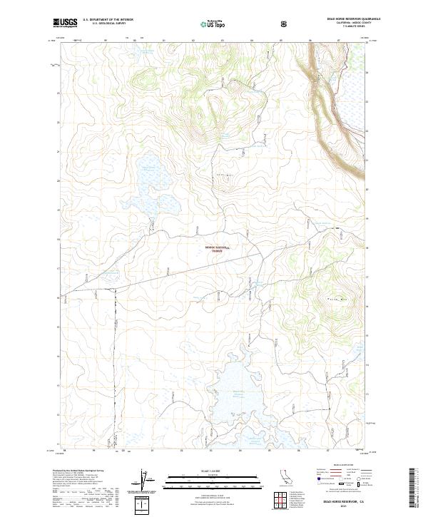
2021 Map of Dead Horse Reservoir
USGS Topo · Published 2021About this map
Modoc National Forest encompasses this arid plateau landscape, defined by a critical network of water management features essential for high-desert survival and land use. The southern portion of the quadrangle is dominated by the sprawling Raker and Thomas Reservoirs, while the namesake Dead Horse Reservoir sits tucked into the western section. These water bodies, along with numerous dispersed basins like Government Reservoir and various numbered stock tanks such as Stock Tank 5 and Stock Tank 10, reflect the area's history as rangeland within the national forest system. Terrain markers like Lost Hill and the prominent North Mtn provide the primary vertical relief against the wide-reaching flats. Vital water sources including Fletcher Spring and Crowder Mountain Spring further emphasize the reliance on isolated hydrologic features in this part of Modoc County.
Find a feature on this map
19 named features on this map. Tap any name to fly to it.
Don’t see what you’re looking for? This feature index may not catch every label — zoom into the map to look around manually.
Map Details
Editions of this 2021 Dead Horse Reservoir Map
This is the sole edition of this map. No revisions or reprints were ever made.
Other maps of this area

1886 · Alturas
USGS Topo · 1:250,000

1892 · Alturas
USGS Topo · 1:250,000

1954 · Alturas
USGS Topo · 1:250,000

1958 · Alturas
USGS Topo · 1:250,000

1962 · Alturas
USGS Topo · 1:250,000

1962 · Davis Creek
USGS Topo · 1:62,500

1962 · Big Sage Reservoir
USGS Topo · 1:62,500

1962 · Willow Ranch
USGS Topo · 1:62,500

1962 · South Mountain
USGS Topo · 1:62,500

1965 · Alturas
USGS Topo · 1:250,000