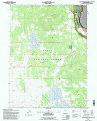
1993 Map of Dead Horse Reservoir
USGS Topo · Published 1997About this map
Modoc National Forest encompasses this high-elevation plateau, where water management is the primary signature on the landscape. The reliance on scattered water sources is evident through the network of naming, including Dead Horse Reservoir and the expansive Raker and Thomas Reservoirs. These features, alongside smaller catchments like Stock Tank 11 and Stock Tank 5, indicate a territory organized for range management and livestock support within the forest boundaries.
Find a feature on this map
20 named features on this map. Tap any name to fly to it.
Don’t see what you’re looking for? This feature index may not catch every label — zoom into the map to look around manually.
Map Details
Editions of this 1993 Dead Horse Reservoir Map
This is the sole edition of this map. No revisions or reprints were ever made.
Other maps of this area

1886 · Alturas
USGS Topo · 1:250,000

1892 · Alturas
USGS Topo · 1:250,000

1954 · Alturas
USGS Topo · 1:250,000

1958 · Alturas
USGS Topo · 1:250,000

1962 · Alturas
USGS Topo · 1:250,000

1962 · Davis Creek
USGS Topo · 1:62,500

1962 · Big Sage Reservoir
USGS Topo · 1:62,500

1962 · Willow Ranch
USGS Topo · 1:62,500

1962 · South Mountain
USGS Topo · 1:62,500

1965 · Alturas
USGS Topo · 1:250,000