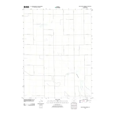
2010 Map of Dead Horse Springs
USGS Topo · Published 2010About this map
Dead Horse Springs and the surrounding high plains of Morgan County are defined by a meticulous grid of rural routes and vital water management systems in this 2010 survey. The landscape is marked by the distinct path of Dead Horse Draw, which cuts through the southern portion of the quadrangle toward the irrigation infrastructure that supports the region's agricultural life. The Riverside Intake Canal and Riverside Ditch are critical components of this water network, situated in the southeastern corner where the terrain meets the necessities of high-desert farming. This era of land management is represented by an extensive network of numbered and lettered thoroughfares, from County Road AA in the south to County Road II at the northern boundary, illustrating the organized section-line development characteristic of the Colorado plains.
Find a feature on this map
22 named features on this map. Tap any name to fly to it.
Don’t see what you’re looking for? This feature index may not catch every label — zoom into the map to look around manually.
Map Details
Editions of this 2010 Dead Horse Springs Map
This is the sole edition of this map. No revisions or reprints were ever made.
Other maps of this area

1951 · Dead Horse Springs
USGS Topo · 1:24,000

1951 · Brush West
USGS Topo · 1:24,000

1951 · Antelope Springs
USGS Topo · 1:24,000

1951 · Brush East
USGS Topo · 1:24,000

1951 · Peace Valley School
USGS Topo · 1:24,000

1951 · Fort Morgan
USGS Topo · 1:24,000

1954 · Sterling
USGS Topo · 1:250,000

1958 · Sterling
USGS Topo · 1:250,000

1971 · Brush East
USGS Topo · 1:24,000
1971 · Brush West
USGS Topo · 1:24,000