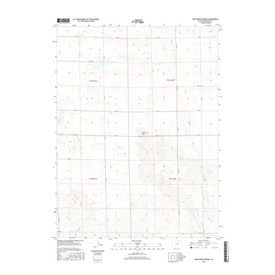
2016 Map of Dead Horse Springs
USGS Topo · Published 2016About this map
Dead Horse Springs and the natural depression of Dead Horse Draw anchor this high plains landscape in eastern Morgan County. The area is defined by a grid-like network of county roads, including Co Rd II and Co Rd 2600, which provide access to a largely agricultural and ranching interior. Water management is a central feature of the local infrastructure, evidenced by the presence of the Riverside Intake Canal and the Riverside Ditch in the southeastern portion of the quadrangle. These irrigation features are critical for sustaining the plains environment, reflecting the historical importance of water rights and engineering in Colorado's development. The topographic contours reveal a landscape of subtle elevation changes, where natural springs and man-made canals are the primary landmarks among the vast sections of the Public Land Survey System.
Find a feature on this map
21 named features on this map. Tap any name to fly to it.
Don’t see what you’re looking for? This feature index may not catch every label — zoom into the map to look around manually.
Map Details
Editions of this 2016 Dead Horse Springs Map
This is the sole edition of this map. No revisions or reprints were ever made.
Other maps of this area

1951 · Dead Horse Springs
USGS Topo · 1:24,000

1951 · Brush West
USGS Topo · 1:24,000

1951 · Antelope Springs
USGS Topo · 1:24,000

1951 · Brush East
USGS Topo · 1:24,000

1951 · Peace Valley School
USGS Topo · 1:24,000

1951 · Fort Morgan
USGS Topo · 1:24,000

1954 · Sterling
USGS Topo · 1:250,000

1958 · Sterling
USGS Topo · 1:250,000

1971 · Brush East
USGS Topo · 1:24,000
1971 · Brush West
USGS Topo · 1:24,000