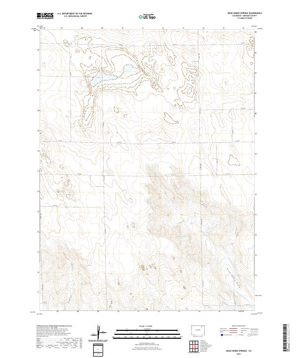
2022 Map of Dead Horse Springs
USGS Topo · Published 2022About this map
Dead Horse Springs lies at the heart of this Morgan County landscape, an area defined by the management of water in an arid environment. The map details the vital irrigation infrastructure of the early 21st century, showing how the Riverside Intake Canal and the Riverside Ditch divert water to support local agriculture. This network follows the natural contours of Dead Horse Draw, a seasonal drainage that shapes the terrain's hydrology. The gridded road system, including routes like Co RD Ii and Co RD 2600, underscores the orderly township and range organization that has governed this region since settlement, providing access to the expansive sections of Colorado's eastern plains.
Find a feature on this map
21 named features on this map. Tap any name to fly to it.
Don’t see what you’re looking for? This feature index may not catch every label — zoom into the map to look around manually.
Map Details
Editions of this 2022 Dead Horse Springs Map
This is the sole edition of this map. No revisions or reprints were ever made.
Other maps of this area

1951 · Dead Horse Springs
USGS Topo · 1:24,000

1951 · Brush West
USGS Topo · 1:24,000

1951 · Antelope Springs
USGS Topo · 1:24,000

1951 · Brush East
USGS Topo · 1:24,000

1951 · Peace Valley School
USGS Topo · 1:24,000

1951 · Fort Morgan
USGS Topo · 1:24,000

1954 · Sterling
USGS Topo · 1:250,000

1958 · Sterling
USGS Topo · 1:250,000

1971 · Brush East
USGS Topo · 1:24,000
1971 · Brush West
USGS Topo · 1:24,000