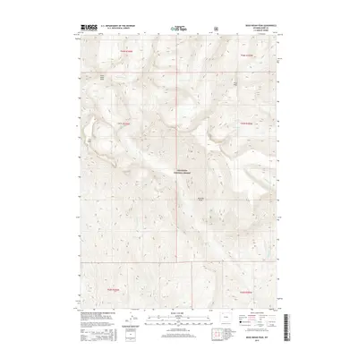
2015 Map of Dead Indian Peak
USGS Topo · Published 2015About this map
Dead Indian Peak and Trout Peak dominate the high-altitude landscape within the Shoshone National Forest, illustrating the dramatic vertical relief of the Absaroka Range. The terrain is defined by extreme drainage patterns, with major tributaries such as Dead Indian Cr, Big Cr, and Trout Cr carving through the mountain system. A notable geological feature, The Wall, stands as a prominent cliff face in the western portion of the quadrangle. The 2015 mapping documents a wilderness area where human infrastructure is largely absent, focusing instead on the complex network of alpine creeks like Grizzly Cr and E Fork Big Cr that feed the region's larger river basins. This survey serves as a detailed record of the high country before modern environmental shifts might alter these high-elevation drainage systems.
Find a feature on this map
18 named features on this map. Tap any name to fly to it.
Don’t see what you’re looking for? This feature index may not catch every label — zoom into the map to look around manually.
Map Details
Editions of this 2015 Dead Indian Peak Map
This is the sole edition of this map. No revisions or reprints were ever made.
Other maps of this area

1893 · Ishawooa
USGS Topo · 1:125,000

1895 · Ishawooa
USGS Topo · 1:125,000

1896 · Crandall Creek
USGS Topo · 1:125,000

1899 · Crandall
USGS Topo · 1:125,000

1899 · Ishawooa
USGS Topo · 1:125,000

1949 · Pat O'Hara Mountain
USGS Topo · 1:62,500

1955 · Cody
USGS Topo · 1:250,000

1956 · Dead Indian Peak
USGS Topo · 1:62,500

1957 · Wapiti
USGS Topo · 1:62,500

1958 · Cody
USGS Topo · 1:250,000