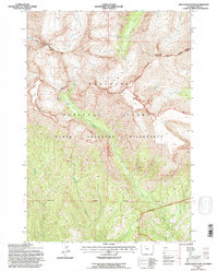
1991 Map of Dead Indian Peak
USGS Topo · Published 1996About this map
Shoshone National Forest defines the high-elevation landscape of this 1991 survey, dominated by the towering summits of Dead Indian Peak 12216 and Trout Peak 12244. The geography is shaped by the complex drainage systems of the North Absaroka Wilderness, where water moves from high alpine basins down through steep canyons. Big Creek Falls serves as a prominent hydrological landmark along Big Creek, while other drainages like Gravelbar Creek and Dead Indian Creek carve deep through the volcanic terrain of the Absaroka Range.
Find a feature on this map
17 named features on this map. Tap any name to fly to it.
Don’t see what you’re looking for? This feature index may not catch every label — zoom into the map to look around manually.
Map Details
Editions of this 1991 Dead Indian Peak Map
This is the sole edition of this map. No revisions or reprints were ever made.
Other maps of this area

1893 · Ishawooa
USGS Topo · 1:125,000

1895 · Ishawooa
USGS Topo · 1:125,000

1896 · Crandall Creek
USGS Topo · 1:125,000

1899 · Crandall
USGS Topo · 1:125,000

1899 · Ishawooa
USGS Topo · 1:125,000

1949 · Pat O'Hara Mountain
USGS Topo · 1:62,500

1955 · Cody
USGS Topo · 1:250,000

1956 · Dead Indian Peak
USGS Topo · 1:62,500

1957 · Wapiti
USGS Topo · 1:62,500

1958 · Cody
USGS Topo · 1:250,000