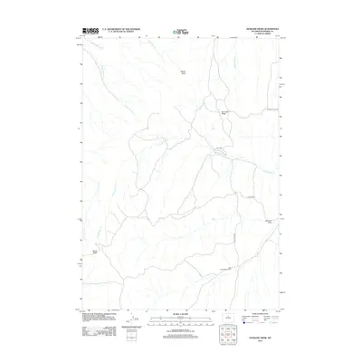
2012 Map of Deadline Draw
USGS Topo · Published 2012About this map
Blue Bank Shearing Pens anchors the southeastern reach of this high-desert landscape in Washakie County, Wyoming. The terrain is defined by a network of drainage systems including Tepee Pole Draw and Hawks Nest Fork, which carve through a series of prominent elevations like Middle Butte and South Butte. This 2012 survey illustrates a sparsely populated region primarily utilized for ranching and resource management, as evidenced by the presence of The Dugout along the N Fork Buffalo Cr.
Find a feature on this map
14 named features on this map. Tap any name to fly to it.
Don’t see what you’re looking for? This feature index may not catch every label — zoom into the map to look around manually.
Map Details
Editions of this 2012 Deadline Draw Map
This is the sole edition of this map. No revisions or reprints were ever made.
Other maps of this area

1955 · Arminto
USGS Topo · 1:250,000

1958 · Arminto
USGS Topo · 1:250,000

1962 · Arminto
USGS Topo · 1:250,000

1966 · Deadline Draw
USGS Topo · 1:24,000

1966 · Indian Creek
USGS Topo · 1:24,000

1966 · Sand Point
USGS Topo · 1:24,000

1966 · Cabin Fork
USGS Topo · 1:24,000
1966 · Joe Emge Creek
USGS Topo · 1:24,000

1966 · Wagon Prong
USGS Topo · 1:24,000

1966 · Bader Draw
USGS Topo · 1:24,000