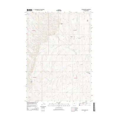
2015 Map of Deadline Draw
USGS Topo · Published 2015About this map
Middle Butte and South Butte anchor the high ground of this central Wyoming landscape, where the drainage patterns of the Big Horn Basin carve deep into the plateau. The terrain is defined by a network of seasonal draws and forks, most notably the N Fork Buffalo Cr which feeds into the Buffalo Reservoir. This 2015 survey reveals an arid landscape managed primarily for grazing and resource access, evidenced by the presence of high ridges such as Little Cedar Ridge and Big Cedar Ridge. A sparse network of unpaved transit ways, including Blue Bank Rd and Buffalo Creek Rd, provides the only infrastructure across this segment of Washakie County. The mapping of Tepee Pole Draw and Hawks Nest Fork reflects the intricate natural hydrology that dictates the movement of wildlife and livestock in this open range country.
Find a feature on this map
17 named features on this map. Tap any name to fly to it.
Don’t see what you’re looking for? This feature index may not catch every label — zoom into the map to look around manually.
Map Details
Editions of this 2015 Deadline Draw Map
This is the sole edition of this map. No revisions or reprints were ever made.
Other maps of this area

1955 · Arminto
USGS Topo · 1:250,000

1958 · Arminto
USGS Topo · 1:250,000

1962 · Arminto
USGS Topo · 1:250,000

1966 · Deadline Draw
USGS Topo · 1:24,000

1966 · Indian Creek
USGS Topo · 1:24,000

1966 · Sand Point
USGS Topo · 1:24,000

1966 · Cabin Fork
USGS Topo · 1:24,000
1966 · Joe Emge Creek
USGS Topo · 1:24,000

1966 · Wagon Prong
USGS Topo · 1:24,000

1966 · Bader Draw
USGS Topo · 1:24,000