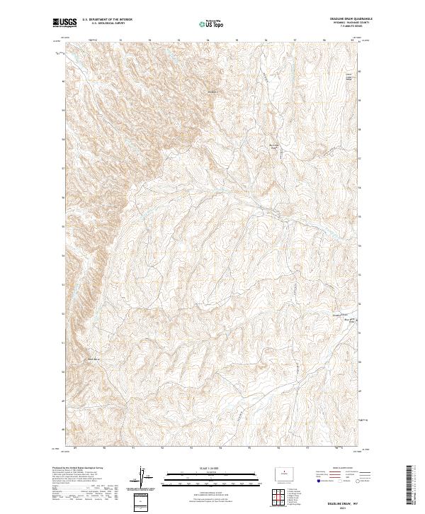
2021 Map of Deadline Draw
USGS Topo · Published 2021About this map
Mid Butte and South Butte anchor this high desert landscape within the Big Horn Basin drainage, where the terrain is carved by a complex network of ephemeral forks and draws. The map illustrates a remote grazing or hunting territory defined by drainage systems like the Joe Henry Fork and the extensive North Fork Buffalo Creek. These waterways, including Tepee Pole Draw and Hawks Nest Fork, suggest a landscape shaped by seasonal runoff and long-term erosion. Human activity is represented by the limited road network, primarily Blue Bank Rd and Buffalo Creek Rd, which provide access through the distinct uplifted formations of Little Cedar Ridge and Big Cedar Ridge. This document is a precise record of the physical geography and public land survey boundaries for this portion of Washakie County.
Find a feature on this map
18 named features on this map. Tap any name to fly to it.
Don’t see what you’re looking for? This feature index may not catch every label — zoom into the map to look around manually.
Map Details
Editions of this 2021 Deadline Draw Map
This is the sole edition of this map. No revisions or reprints were ever made.
Other maps of this area

1955 · Arminto
USGS Topo · 1:250,000

1958 · Arminto
USGS Topo · 1:250,000

1962 · Arminto
USGS Topo · 1:250,000

1966 · Deadline Draw
USGS Topo · 1:24,000

1966 · Indian Creek
USGS Topo · 1:24,000

1966 · Sand Point
USGS Topo · 1:24,000

1966 · Cabin Fork
USGS Topo · 1:24,000
1966 · Joe Emge Creek
USGS Topo · 1:24,000

1966 · Wagon Prong
USGS Topo · 1:24,000

1966 · Bader Draw
USGS Topo · 1:24,000