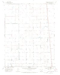
1968 Map of Deadman Camp SW
USGS Topo · Published 1970About this map
The Saguache County landscape presented here in the late 1960s is defined by a sophisticated system of water management designed to sustain agricultural life in the San Luis Valley. The Farmers Union Canal and Gibson Ditch anchor a grid of water distribution that includes the North Lateral, North Central Lateral, and Lateral Fortyseven. This intricate network of man-made waterways, supplemented by numerous Flowing Wells, illustrates the transition of the high desert into productive ranching and farming land. The terrain is remarkably level, etched with straight-line surveying and the occasional presence of Cotton Road, providing a clear look at mid-century rural infrastructure before modern consolidation changed many of these smaller water-rights features.
Find a feature on this map
10 named features on this map. Tap any name to fly to it.
Don’t see what you’re looking for? This feature index may not catch every label — zoom into the map to look around manually.
Map Details
Editions of this 1968 Deadman Camp SW Map
2 editions found
Other maps of this area

1915 · Del Norte
USGS Topo · 1:125,000

1917 · Del Norte
USGS Topo · 1:125,000

1945 · Durango
USGS Topo · 1:250,000

1953 · Durango
USGS Topo · 1:250,000

1954 · Durango
USGS Topo · 1:250,000

1954 · Trinidad
USGS Topo · 1:250,000

1955 · Trinidad
USGS Topo · 1:250,000

1958 · Trinidad
USGS Topo · 1:250,000

1959 · Trinidad
USGS Topo · 1:250,000

1961 · Durango
USGS Topo · 1:250,000