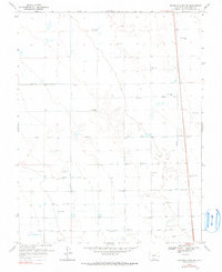
1968 Map of Deadman Camp Sw
USGS Topo · Published 1990About this map
Hydrological engineering defines this Saguache County landscape, where an intricate network of irrigation channels supported high-altitude agriculture in the late 1960s. The prominent Farmers Union Canal and Gibson Ditch anchor a system of distribution that includes the North Central Lateral, Lateral Fortyseven, and Cotton Road Lateral. Numerous sites labeled simply as Flowing Well, Well, or Wells are scattered across the terrain, indicating a heavy reliance on groundwater management. The map's layout of geometric survey sections and named laterals, such as the North Lateral and Central Lateral, illustrates the deliberate effort to bring water to this arid region for ranching or farming use.
Find a feature on this map
12 named features on this map. Tap any name to fly to it.
Don’t see what you’re looking for? This feature index may not catch every label — zoom into the map to look around manually.
Map Details
Editions of this 1968 Deadman Camp Sw Map
2 editions found
Other maps of this area

1915 · Del Norte
USGS Topo · 1:125,000

1917 · Del Norte
USGS Topo · 1:125,000

1945 · Durango
USGS Topo · 1:250,000

1953 · Durango
USGS Topo · 1:250,000

1954 · Durango
USGS Topo · 1:250,000

1954 · Trinidad
USGS Topo · 1:250,000

1955 · Trinidad
USGS Topo · 1:250,000

1958 · Trinidad
USGS Topo · 1:250,000

1959 · Trinidad
USGS Topo · 1:250,000

1961 · Durango
USGS Topo · 1:250,000