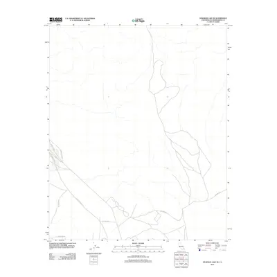
2012 Map of Deadman Lake SE
USGS Topo · Published 2012About this map
The vast military landscape of the 29 Palms MCAG dominates this desert region in San Bernardino County. This 2012 survey illustrates a sparse network of roads designed for access within the high-desert training grounds of the Marine Corps Air Ground Combat Center. Notable transit routes including Rainbow Canyon Rd and Mesquite Springs Rd cross the arid terrain, leading toward the northern and western reaches of the training area. At the southern edge of the map, the transition toward the community of Twentynine Palms begins with the appearance of Montezuma Dr. The map provides a clear picture of the modern infrastructure required to support one of the military's largest live-fire training installations, showing how these designated roads navigate the natural drainage patterns and dry washes of the desert floor.
Find a feature on this map
4 named features on this map. Tap any name to fly to it.
Don’t see what you’re looking for? This feature index may not catch every label — zoom into the map to look around manually.
Map Details
Editions of this 2012 Deadman Lake SE Map
This is the sole edition of this map. No revisions or reprints were ever made.
Other maps of this area

1942 · Amboy
USGS Topo · 1:250,000

1943 · Amboy
USGS Topo · 1:250,000

1953 · San Bernardino
USGS Topo · 1:250,000

1954 · Needles
USGS Topo · 1:250,000

1954 · Valley Mtn
USGS Topo · 1:24,000

1955 · Deadman Lake NW
USGS Topo · 1:24,000

1955 · Lead Mountain
USGS Topo · 1:24,000

1955 · Deadman Lake SE
USGS Topo · 1:24,000

1955 · Deadman Lake NE
USGS Topo · 1:24,000

1955 · Deadman Lake SW
USGS Topo · 1:24,000