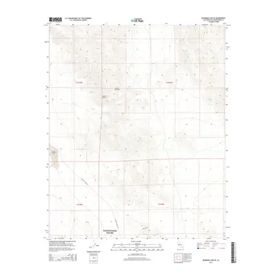
2015 Map of Deadman Lake SE
USGS Topo · Published 2015About this map
The Twentynine Palms military installation occupies a significant portion of this high-desert landscape within the Mojave Desert. The terrain is dominated by the striking elevation changes of the Bullion Mountains, which rise sharply from the basin floor. This 2015 survey captures the intersection of restrictive land use and desert geography, with the dry bed of Deadman Lake appearing on the western edge of the quadrangle. Access across this arid expanse is limited to remote tracks such as Rainbow Canyon Rd and the informally named Boonies Blvd, reflecting the area's primary function for training and tactical operations. The map provides a clear look at the township and range survey lines, including t3n r8e and t2n r9e, which organize this sparsely populated corner of San Bernardino County.
Find a feature on this map
10 named features on this map. Tap any name to fly to it.
Don’t see what you’re looking for? This feature index may not catch every label — zoom into the map to look around manually.
Map Details
Editions of this 2015 Deadman Lake SE Map
This is the sole edition of this map. No revisions or reprints were ever made.
Other maps of this area

1942 · Amboy
USGS Topo · 1:250,000

1943 · Amboy
USGS Topo · 1:250,000

1953 · San Bernardino
USGS Topo · 1:250,000

1954 · Needles
USGS Topo · 1:250,000

1954 · Valley Mtn
USGS Topo · 1:24,000

1955 · Deadman Lake NW
USGS Topo · 1:24,000

1955 · Lead Mountain
USGS Topo · 1:24,000

1955 · Deadman Lake SE
USGS Topo · 1:24,000

1955 · Deadman Lake NE
USGS Topo · 1:24,000

1955 · Deadman Lake SW
USGS Topo · 1:24,000