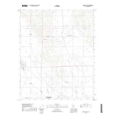
2018 Map of Deadman Lake SE
USGS Topo · Published 2018About this map
Twentynine Palms serves as the primary landmark in the southern reaches of this arid landscape, situated at the edge of the Mojave Desert. The topography is dominated by the Bullion Mountains, which rise sharply through the center of the survey area, creating a complex network of ridges and canyons. This 2018 data illustrates the modern road network servicing the high desert, including the Bagdad Hwy cutting north-south and several smaller arteries like Rainbow Canyon Rd and Mesquite Springs Rd. The map provides a clear look at the Public Land Survey System grid, shown through township and range boundaries such as t3n r8e and t2n r9e. Local routes like Boonies Blvd and Montezuma Rd provide access to the foothills, showing how the desert floor meets the steep mountain terrain near the northern boundary of the settlement area.
Find a feature on this map
13 named features on this map. Tap any name to fly to it.
Don’t see what you’re looking for? This feature index may not catch every label — zoom into the map to look around manually.
Map Details
Editions of this 2018 Deadman Lake SE Map
This is the sole edition of this map. No revisions or reprints were ever made.
Other maps of this area

1942 · Amboy
USGS Topo · 1:250,000

1943 · Amboy
USGS Topo · 1:250,000

1953 · San Bernardino
USGS Topo · 1:250,000

1954 · Needles
USGS Topo · 1:250,000

1954 · Valley Mtn
USGS Topo · 1:24,000

1955 · Deadman Lake NW
USGS Topo · 1:24,000

1955 · Lead Mountain
USGS Topo · 1:24,000

1955 · Deadman Lake SE
USGS Topo · 1:24,000

1955 · Deadman Lake NE
USGS Topo · 1:24,000

1955 · Deadman Lake SW
USGS Topo · 1:24,000