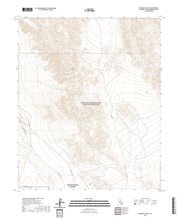
2021 Map of Deadman Lake SE
USGS Topo · Published 2021About this map
Twentynine Palms borders the southern edge of this high desert landscape, where the residential grid meets the open terrain of the Mojave Desert. The topography is dominated by the Bullion Mountains, which rise sharply through the center of the sheet, creating a complex series of ridges and canyons. The transport network reflects the area's isolation and strategic positioning, centered around the Bagdad Hwy and several long, unpaved routes like Rainbow Canyon Rd and Botkin Rd. The transition from the developed margins of the city to the uninhabited mountain interior is abrupt, marked only by these few arterial roads and the occasional trail like Mesquite Springs Rd. This survey shows the modern extent of the settlement area against the backdrop of the protected mountain wilderness.
Find a feature on this map
13 named features on this map. Tap any name to fly to it.
Don’t see what you’re looking for? This feature index may not catch every label — zoom into the map to look around manually.
Map Details
Editions of this 2021 Deadman Lake SE Map
This is the sole edition of this map. No revisions or reprints were ever made.
Other maps of this area

1942 · Amboy
USGS Topo · 1:250,000

1943 · Amboy
USGS Topo · 1:250,000

1953 · San Bernardino
USGS Topo · 1:250,000

1954 · Needles
USGS Topo · 1:250,000

1954 · Valley Mtn
USGS Topo · 1:24,000

1955 · Deadman Lake NW
USGS Topo · 1:24,000

1955 · Lead Mountain
USGS Topo · 1:24,000

1955 · Deadman Lake SE
USGS Topo · 1:24,000

1955 · Deadman Lake NE
USGS Topo · 1:24,000

1955 · Deadman Lake SW
USGS Topo · 1:24,000