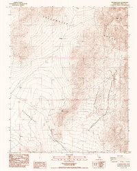
1987 Map of Deadman Pass
USGS Topo · Published 1987About this map
Greenwater Range dominates this desert landscape, its jagged topography rising sharply above the expansive Greenwater Valley in Inyo County. This 1987 provisional survey reveals a terrain defined by mineral exploration and high-altitude landmarks, where numerous prospects and a singular prospect dot the slopes of the range. These markings suggest a history of small-scale mining efforts seeking fortunes in the arid hills near Deadman Pass.
Find a feature on this map
9 named features on this map. Tap any name to fly to it.
Don’t see what you’re looking for? This feature index may not catch every label — zoom into the map to look around manually.
Map Details
Editions of this 1987 Deadman Pass Map
This is the sole edition of this map. No revisions or reprints were ever made.
Other maps of this area

1908 · Furnace Creek
USGS Topo · 1:250,000

1910 · Furnace Creek
USGS Topo · 1:250,000

1933 · Avawatz Mountains
USGS Topo · 1:250,000

1940 · Eagle Tank
USGS Topo · 1:62,500

1947 · Trona
USGS Topo · 1:250,000

1948 · Trona
USGS Topo · 1:250,000

1948 · Death Valley
USGS Topo · 1:250,000

1950 · Confidence Hills
USGS Topo · 1:62,500

1951 · Funeral Peak
USGS Topo · 1:62,500

1951 · Eagle Mtn
USGS Topo · 1:62,500