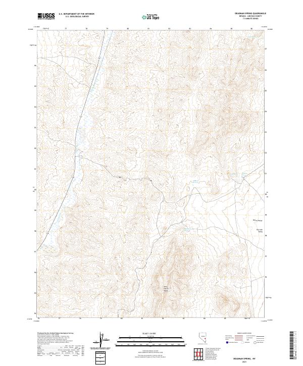
2021 Map of Deadman Spring
USGS Topo · Published 2021About this map
Cabin Spring marks a vital water point in this high-desert region of Lincoln County, Nevada, where the drainage patterns suggest a landscape defined by intermittent water flow and significant elevation changes. The topography around the spring reflects the remote character of this part of the state, where localized water sources were essential for ranching and early travel through the Great Basin. This 2021 update by the U.S. Geological Survey provides a precise view of the terrain near the North Pahroc Range, highlighting the isolated landmarks that have long served as navigational aids in the high desert. Researchers can trace the modern road network against the traditional topographic features, revealing how human access and land management continue to interact with this arid environment.
Find a feature on this map
1 named feature on this map. Tap any name to fly to it.
Don’t see what you’re looking for? This feature index may not catch every label — zoom into the map to look around manually.
Map Details
Editions of this 2021 Deadman Spring Map
This is the sole edition of this map. No revisions or reprints were ever made.
Other maps of this area

1885 · Pioche
USGS Topo · 1:250,000

1886 · Pioche
USGS Topo · 1:250,000

1954 · Caliente
USGS Topo · 1:250,000

1956 · Lund
USGS Topo · 1:250,000

1959 · Caliente
USGS Topo · 1:250,000

1960 · Lund
USGS Topo · 1:250,000
1970 · Deadman Spring
USGS Topo · 1:24,000
1970 · Deadman Spring SE
USGS Topo · 1:24,000

1970 · Wheatgrass Spring
USGS Topo · 1:24,000
1970 · Deadman Spring NE
USGS Topo · 1:24,000