
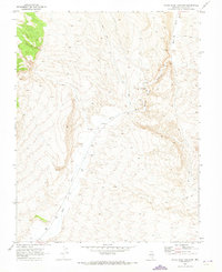
1970 Map of Wheatgrass Spring
USGS Topo · Published 1973About this map
The North Pahroc Range dominates this landscape in Lincoln County, Nevada, where the high desert terrain is defined by its vital water sources. In an arid environment where survival relied on the proximity of springs, this 1970 survey records several named outlets including Wheatgrass Spring, Pace Spring, and Rattlesnake Spring. A prominent Water Tank located near the center of the range suggests the area's utility for livestock or remote operations during this era. To the east, the basin of Dry Lake Valley spreads out from the base of the mountains, while the drainage of Wheatgrass Wash carves a path through the southern foothills. The map is networked with a series of Jeep Trails, indicating the limited but established access routes used by ranchers and land managers across this portion of the Great Basin.
Find a feature on this map
8 named features on this map. Tap any name to fly to it.
Don’t see what you’re looking for? This feature index may not catch every label — zoom into the map to look around manually.
Map Details
Editions of this 1970 Wheatgrass Spring Map
This is the sole edition of this map. No revisions or reprints were ever made.
Other maps of this area

1885 · Pioche
USGS Topo · 1:250,000

1886 · Pioche
USGS Topo · 1:250,000

1954 · Caliente
USGS Topo · 1:250,000

1959 · Caliente
USGS Topo · 1:250,000

1970 · Hiko NE
USGS Topo · 1:24,000
1970 · Deadman Spring
USGS Topo · 1:24,000
1970 · Deadman Spring SE
USGS Topo · 1:24,000
1970 · Deadman Spring NE
USGS Topo · 1:24,000
1970 · Weepah Spring
USGS Topo · 1:24,000
1970 · White River Narrows
USGS Topo · 1:24,000