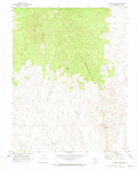
1970 Map of Weepah Spring
USGS Topo · Published 1973About this map
Timber Mountain and the Seaman Range dominate this high-desert terrain in Lincoln County, where life and travel centered around critical water sources. The map highlights the isolation of these peaks during the early 1970s, as the only established routes through the area are designated as Jeep Trail. This network of unpaved tracks connects the scattered hydrologic features essential for survival in the arid environment, including Weepah Spring and White Rock Spring. Near the southeast corner, the White River and associated Water Tanks represent the most developed infrastructure in an otherwise undeveloped landscape. The survey also precisely marks the Base Line, a fundamental surveying boundary that dictates the legal division of this remote Nevada interior.
Find a feature on this map
8 named features on this map. Tap any name to fly to it.
Don’t see what you’re looking for? This feature index may not catch every label — zoom into the map to look around manually.
Map Details
Editions of this 1970 Weepah Spring Map
This is the sole edition of this map. No revisions or reprints were ever made.
Other maps of this area

1885 · Pioche
USGS Topo · 1:250,000

1886 · Pioche
USGS Topo · 1:250,000

1954 · Caliente
USGS Topo · 1:250,000

1956 · Lund
USGS Topo · 1:250,000

1959 · Caliente
USGS Topo · 1:250,000

1960 · Lund
USGS Topo · 1:250,000

1970 · Oreana Spring
USGS Topo · 1:24,000

1970 · Seaman Wash
USGS Topo · 1:24,000
1970 · Deadman Spring
USGS Topo · 1:24,000

1970 · Wheatgrass Spring
USGS Topo · 1:24,000