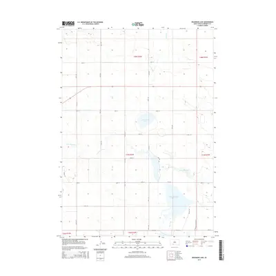
2015 Map of Deadmans Lake
USGS Topo · Published 2015About this map
Deadmans Lake sits at the center of this prairie landscape, serving as a primary hydrologic landmark in a region defined by its managed water resources and wildlife corridors. The drainage systems of Spring Cr and the meandering Little White River converge toward the south, where the Little White River Pool Reservoir and Lake Creek indicate a significant wetland and conservation environment. This 2015 USGS survey illustrates the modern grid of rural section roads, such as 290th St and 228th Ave, that overlay the natural drainage patterns of the High Plains. The southern portion of the quadrangle is notably occupied by the administrative and physical boundaries of the LaCreek Wildlife Refuge Rd, reflecting the area's transition from open grazing land to a structured federal conservation zone.
Find a feature on this map
26 named features on this map. Tap any name to fly to it.
Don’t see what you’re looking for? This feature index may not catch every label — zoom into the map to look around manually.
Map Details
Editions of this 2015 Deadmans Lake Map
This is the sole edition of this map. No revisions or reprints were ever made.
Other maps of this area

1955 · Martin
USGS Topo · 1:250,000

1958 · Martin
USGS Topo · 1:250,000

1981 · Patricia
USGS Topo · 1:25,000

1981 · Phantom Lake
USGS Topo · 1:25,000

1981 · Martin
USGS Topo · 1:25,000

1981 · Blackpipe
USGS Topo · 1:25,000

1981 · Scotchman Lake
USGS Topo · 1:25,000

1981 · Tuthill
USGS Topo · 1:25,000

1983 · Martin
USGS Topo · 1:100,000
2012 · Scotchman Lake
USGS Topo · 1:24,000