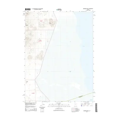
2014 Map of Deardens Knoll
USGS Topo · Published 2014About this map
Great Salt Lake dominates the eastern expanse of this Tooele County landscape, with its waters reaching into Carrington Bay. The terrain transitions sharply from the saline flats and shoreline of the lake to the elevated ridges of the Lakeside Mountains in the west. This 2014 survey documents a largely undeveloped stretch of the Utah desert where the county line between Box Elder and Tooele counties is clearly demarcated. The geography is defined by isolated topographic rises such as Deardens Knoll and Richins Knoll, providing essential landmarks in an otherwise open environment. To the north, Sally Mtn serves as a prominent high point, marking the rugged character of the mountain range as it overlooks the salt-crusted basins below.
Find a feature on this map
10 named features on this map. Tap any name to fly to it.
Don’t see what you’re looking for? This feature index may not catch every label — zoom into the map to look around manually.
Map Details
Editions of this 2014 Deardens Knoll Map
This is the sole edition of this map. No revisions or reprints were ever made.
Other maps of this area

1885 · Tooele Valley
USGS Topo · 1:250,000

1953 · Tooele
USGS Topo · 1:250,000

1954 · Brigham City
USGS Topo · 1:250,000

1955 · Tooele
USGS Topo · 1:250,000

1958 · Brigham City
USGS Topo · 1:250,000

1962 · Brigham City
USGS Topo · 1:250,000

1968 · Carrington Island SW
USGS Topo · 1:24,000

1968 · Deardens Knoll
USGS Topo · 1:24,000

1968 · Badger Island NW
USGS Topo · 1:24,000

1968 · Craner Peak
USGS Topo · 1:24,000