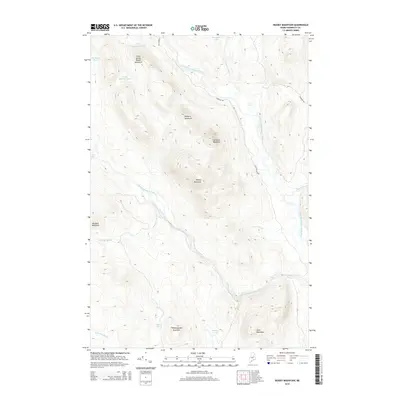
2014 Map of Deasey Mountain
USGS Topo · Published 2014About this map
Deasey Mountain and the surrounding peaks of Penobscot County define this section of the Maine interior, where the East Branch Penobscot River winds southward through a landscape of ridges and waterways. The map illustrates a drainage system shaped by the Wassataquoik Stream and Lunksoos Stream, which feed into the primary river valley. High-elevation points like Lunksoos Mountain, Hathorn Mountain, and Wassataquoik Mountain frame the river corridor, while smaller water bodies such as Little Hathorn Pond and Deasey Ponds are tucked into the upland folds. Access to this remote timber and recreational country is primarily via the unpaved E Branch Rd and Lunksoos Rd. Notable water features including Orin Falls and Gilman Falls provide evidence of the steep drops and hydraulic energy present in these northern streams.
Find a feature on this map
25 named features on this map. Tap any name to fly to it.
Don’t see what you’re looking for? This feature index may not catch every label — zoom into the map to look around manually.
Map Details
Editions of this 2014 Deasey Mountain Map
This is the sole edition of this map. No revisions or reprints were ever made.
Other maps of this area

1927 · Katahdin
USGS Topo · 1:48,000

1930 · Katahdin
USGS Topo · 1:62,500

1949 · Katahdin
USGS Topo · 1:62,500

1953 · Stacyville
USGS Topo · 1:62,500

1954 · Shin Pond
USGS Topo · 1:62,500

1954 · Presque Isle
USGS Topo · 1:250,000

1954 · Millinocket
USGS Topo · 1:250,000

1955 · Traveler Mountain
USGS Topo · 1:62,500

1958 · Presque Isle
USGS Topo · 1:250,000

1958 · Millinocket
USGS Topo · 1:250,000