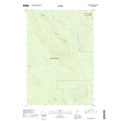
2021 Map of Deasey Mountain
USGS Topo · Published 2021About this map
Katahdin Woods and Waters National Monument dominates this interior Maine landscape, protecting a complex network of high peaks and river valleys in Penobscot County. The topographical character is defined by significant elevations like Deasey Mtn and Lunksoos Mtn, which overlook the winding course of the East Branch Penobscot River. This area has long been shaped by the logging industry, evidenced by the presence of Hauling Road 1 and Lunksoos Rd, which provide access through the dense woodlands. The hydrology of the region is particularly intricate, featuring dramatic water drops at Orin Falls and Gilman Falls along the Wassataquoik Stream. From the high ridges of Hathorn Mtn to the secluded Deasey Ponds, the map illustrates a wilderness area where the mountain terrain meets the essential waterways of the Maine north woods.
Find a feature on this map
24 named features on this map. Tap any name to fly to it.
Don’t see what you’re looking for? This feature index may not catch every label — zoom into the map to look around manually.
Map Details
Editions of this 2021 Deasey Mountain Map
This is the sole edition of this map. No revisions or reprints were ever made.
Other maps of this area

1927 · Katahdin
USGS Topo · 1:48,000

1930 · Katahdin
USGS Topo · 1:62,500

1949 · Katahdin
USGS Topo · 1:62,500

1953 · Stacyville
USGS Topo · 1:62,500

1954 · Shin Pond
USGS Topo · 1:62,500

1954 · Presque Isle
USGS Topo · 1:250,000

1954 · Millinocket
USGS Topo · 1:250,000

1955 · Traveler Mountain
USGS Topo · 1:62,500

1958 · Presque Isle
USGS Topo · 1:250,000

1958 · Millinocket
USGS Topo · 1:250,000