
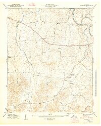
1936 Map of Deason
USGS Topo · Published 1936About this map
The northern edge of Shelbyville and the farming community of Deason anchor this mid-1930s landscape, where the Tennessee Basin Divide cuts across the northeastern corner. The area is defined by a dense network of local institutions, including rural schools like Sulphur Springs Sch and McDale Sch, and educational landmarks such as Coops Academy and Bomar Academy. The presence of the County Farm near Horse Mtn reflects the social infrastructure of the Depression era, while the extensive reach of the Electric Membership Corporation Trans Line signals the early modernization of rural Tennessee.
Find a feature on this map
35 named features on this map. Tap any name to fly to it.
Don’t see what you’re looking for? This feature index may not catch every label — zoom into the map to look around manually.
Map Details
Editions of this 1936 Deason Map
This is the sole edition of this map. No revisions or reprints were ever made.
Other maps of this area

1936 · Webbs Jungle
USGS Topo · 1:24,000

1936 · Shelbyville
USGS Topo · 1:24,000

1936 · Rover
USGS Topo · 1:24,000

1936 · Wartrace
USGS Topo · 1:24,000

1936 · Unionville
USGS Topo · 1:24,000

1936 · Bedford
USGS Topo · 1:24,000

1936 · Normandy
USGS Topo · 1:24,000

1936 · Fosterville
USGS Topo · 1:24,000

1944 · Shelbyville
USGS Topo · 1:100,000
1947 · Bedford
USGS Topo · 1:24,000