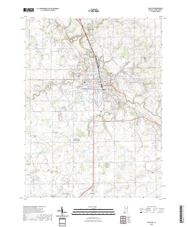
2022 Map of Decatur
USGS Topo · Published 2022About this map
The Saint Marys River meanders through the heart of this landscape, anchoring the city of Decatur, the county seat of Adams County. The settlement pattern is defined by a dense urban grid concentrated around the Adams County Courthouse, transitioning quickly into an extensive network of agricultural drainage ditches such as Holthouse Ditch and Borum Run. This 2022 survey documents the contemporary extent of the city, including the Industrial Park and the nearby Gage Airport. For genealogists, the map identifies several critical burial sites, including Union Chapel Cem, Saint Joseph Cem, and Decatur Cem. To the north and south, smaller hubs like Monmouth, Monroe, and the evocatively named Elm Tree Crossroads provide context for the surrounding rural townships.
Find a feature on this map
79 named features on this map. Tap any name to fly to it.
Don’t see what you’re looking for? This feature index may not catch every label — zoom into the map to look around manually.
Map Details
Editions of this 2022 Decatur Map
This is the sole edition of this map. No revisions or reprints were ever made.
Other maps of this area

1911 · Berne
USGS Topo · 1:48,000

1953 · Muncie
USGS Topo · 1:250,000

1956 · Muncie
USGS Topo · 1:250,000

1960 · Dixon
USGS Topo · 1:24,000
1960 · Wren
USGS Topo · 1:24,000
1960 · Willshire
USGS Topo · 1:24,000

1961 · Hoagland
USGS Topo · 1:24,000

1962 · Poe
USGS Topo · 1:24,000

1962 · Preble
USGS Topo · 1:24,000

1962 · Berne
USGS Topo · 1:24,000