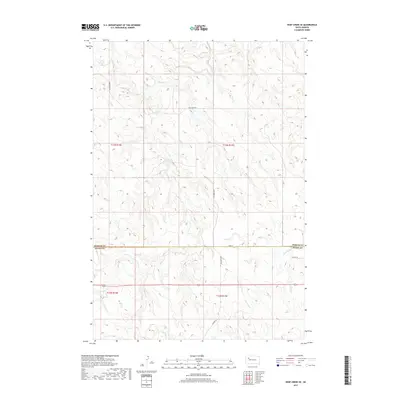
2017 Map of Deep Creek SE
USGS Topo · Published 2017About this map
Deep drainage basins and high plateau divides characterize this landscape along the border of Meade and Perkins counties. The northern portion of the quadrangle is defined by the winding course of Deep Cr, which is served by the rural utility of Deep Creek Rd. As the elevation shifts southward across the Perkins Co Meade Co line, a series of drainages including Flint Cr and Flint Rock Cr carve into the terrain. The area is marked by a sparse network of section-line roads and remote spurs like Tower Rd and Udager Pl, reflecting a vast, open rangeland environment. This 2017 survey details the precise land divisions of the Public Land Survey System, showing the transitions between t13n r14e, t13n r15e, t12n r14e, and t12n r15e.
Find a feature on this map
13 named features on this map. Tap any name to fly to it.
Don’t see what you’re looking for? This feature index may not catch every label — zoom into the map to look around manually.
Map Details
Editions of this 2017 Deep Creek SE Map
This is the sole edition of this map. No revisions or reprints were ever made.
Other maps of this area

1951 · Deep Creek NW
USGS Topo · 1:24,000

1952 · Deep Creek SE
USGS Topo · 1:24,000

1952 · Signal Butte
USGS Topo · 1:24,000

1952 · Deep Creek NE
USGS Topo · 1:24,000

1952 · Faith NW
USGS Topo · 1:24,000

1953 · Rapid City
USGS Topo · 1:250,000

1954 · Lemmon
USGS Topo · 1:250,000

1957 · Lemmon
USGS Topo · 1:250,000

1957 · Rapid City
USGS Topo · 1:250,000

1983 · Lemmon Butte
USGS Topo · 1:24,000