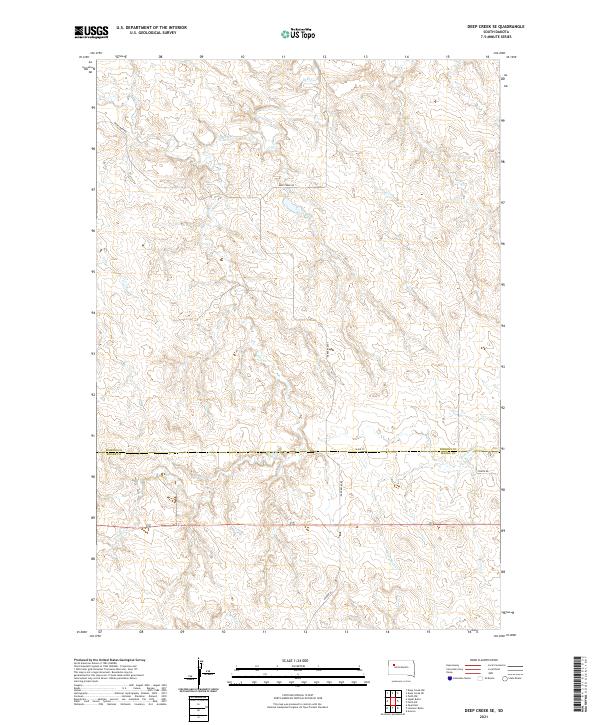
2021 Map of Deep Creek SE
USGS Topo · Published 2021About this map
The rolling grasslands along the Perkins County and Meade County line are defined by a complex network of drainage basins. This modern topographic study shows the convergence of several seasonal waterways, including Deep Creek, Flint Creek, and Flint Rock Creek, which carve out the subtle relief of this Western South Dakota landscape. The map provides a clear picture of rural land division and the sparse road network that serves the area's ranching interests. Local infrastructure is concentrated along Deep Creek Road and 163rd Street, providing access across the township boundaries of t13n r14e and t12n r15e. To the south, North Brushy Creek and Udager Place mark the transition toward more varied terrain, illustrating the geographic character of the region as it appeared in the early 2020s.
Find a feature on this map
13 named features on this map. Tap any name to fly to it.
Don’t see what you’re looking for? This feature index may not catch every label — zoom into the map to look around manually.
Map Details
Editions of this 2021 Deep Creek SE Map
This is the sole edition of this map. No revisions or reprints were ever made.
Other maps of this area

1951 · Deep Creek NW
USGS Topo · 1:24,000

1952 · Deep Creek SE
USGS Topo · 1:24,000

1952 · Signal Butte
USGS Topo · 1:24,000

1952 · Deep Creek NE
USGS Topo · 1:24,000

1952 · Faith NW
USGS Topo · 1:24,000

1953 · Rapid City
USGS Topo · 1:250,000

1954 · Lemmon
USGS Topo · 1:250,000

1957 · Lemmon
USGS Topo · 1:250,000

1957 · Rapid City
USGS Topo · 1:250,000

1983 · Lemmon Butte
USGS Topo · 1:24,000